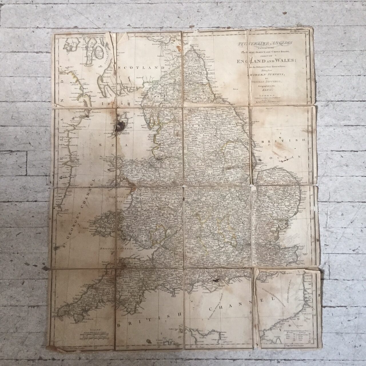
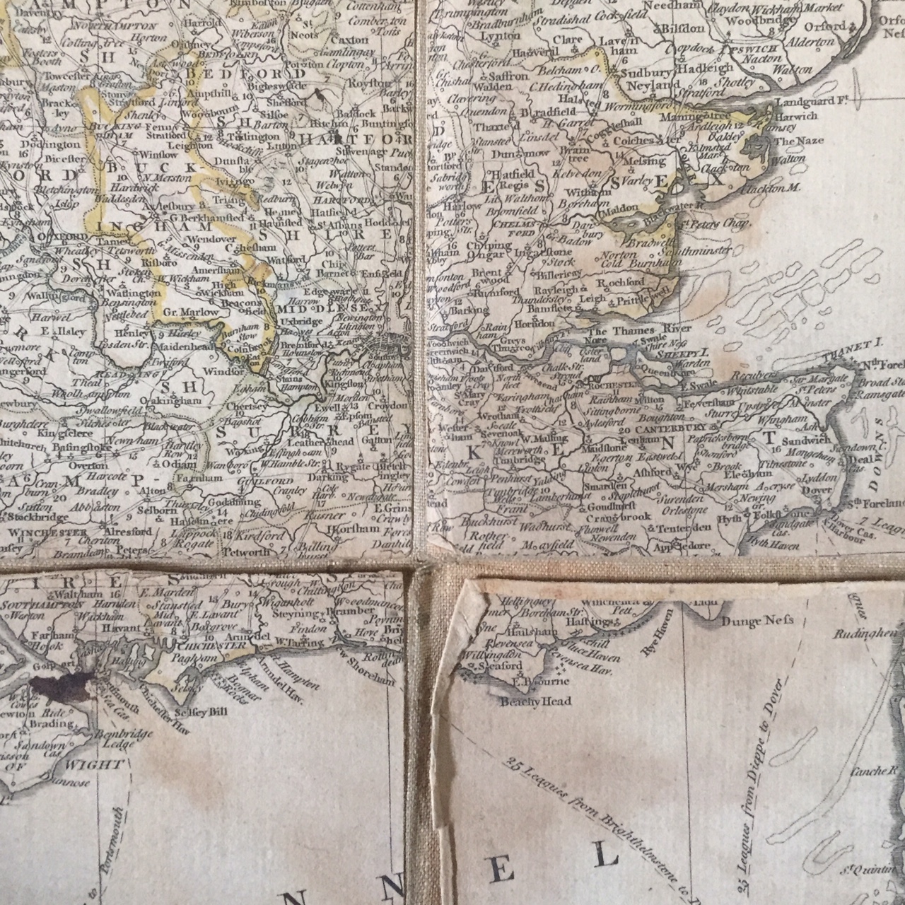
Map of England 1771 by Thomas Jefferys
$475.00
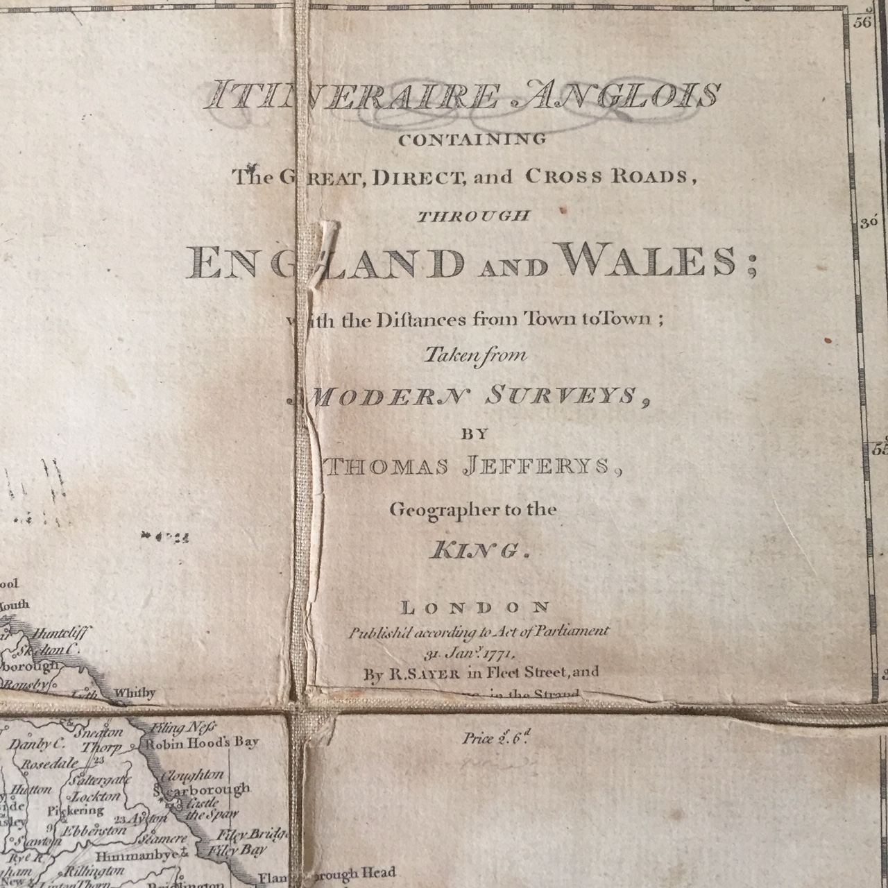
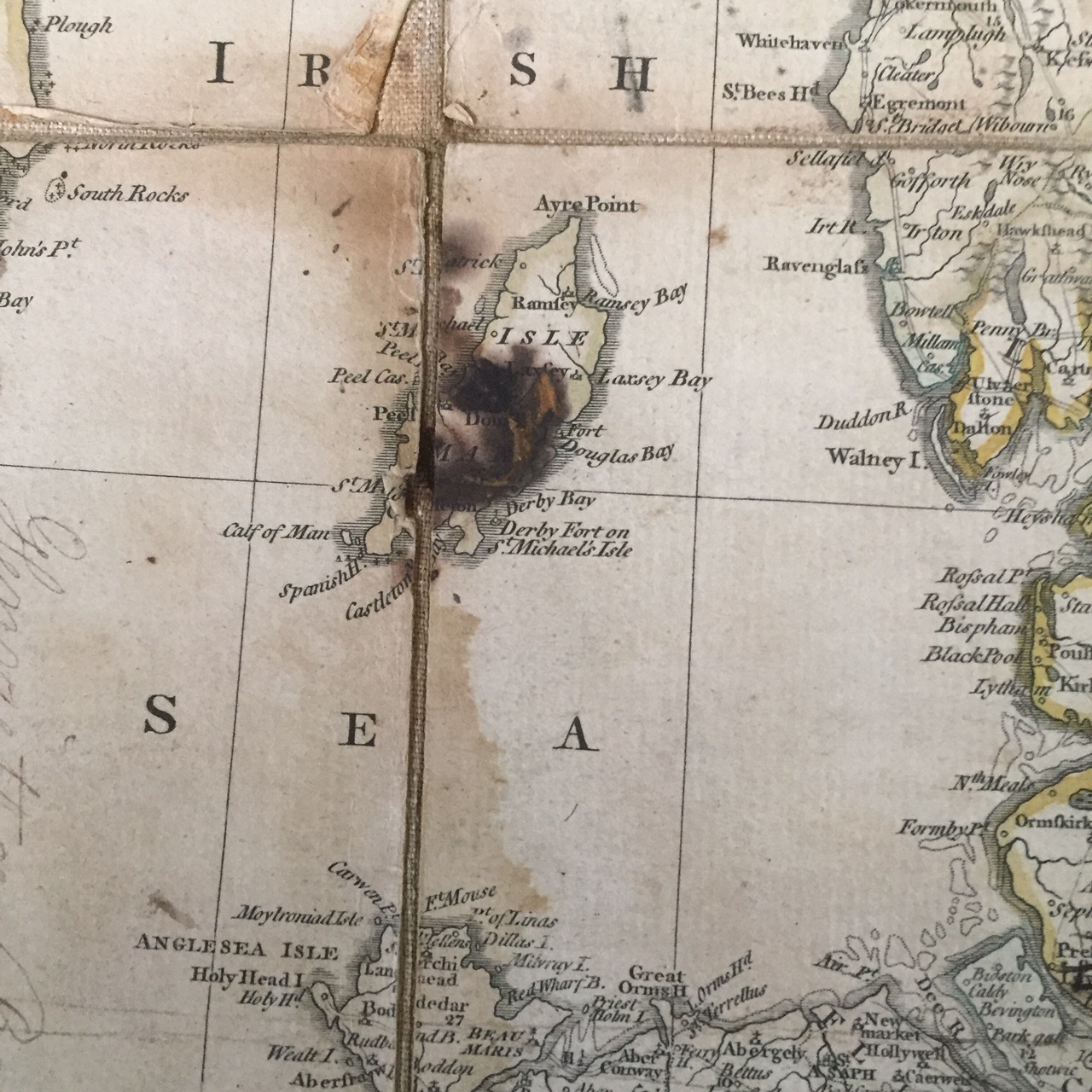
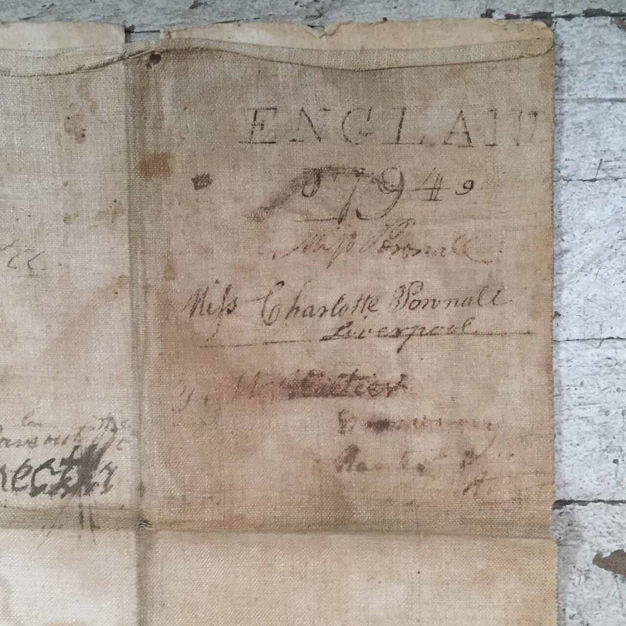
Thomas Jefferys (c. 1719 – 1771), “Geographer to King George III”, was an English cartographer who was the leading map supplier of his day. He engraved and printed maps for government and other official bodies and produced a wide range of commercial maps and atlases, especially of North America. This map of England dated January 1771, is made up of 16 individual panels held together by a linen backing. Each section is approximately 4 1/2“ x 5 1/4“ for total size of approximately 18” x 21“. There is some minor damage to the linen backing in the folds of the map and the edges of the paper sections of the map itself. The Isle of Man appears to have been scorched at some point. Jefferys died in November 1771,
In excellent condition for a map of its age.